I decided to start a blog specifically for my storm chasing. I will no longer be posting the chase reports on this blog. I will however, be posting highlight photographs and a link to the storm chasing blog. Be sure to subscribe to learn about possible chases and I also have a live stream link in there as well and now you can follow along on a chase.
Thanks.
-Ben
Majestic Noise

Thursday, September 23, 2010

Thursday, September 16, 2010
Have You Picked Up Your WFLAR Today?...
This season features 100+ pages of captivating photography, inspiring poetry/prose, and insightful articles all from local Wichita Falls artists. I was not the only photographer featured in this WFLAR. Mark Moody, Elisabeth Hawley, and Richard Carter, are just a few of the several photographers showcasing their images. The WFLAR is a great non profit organization promoting literature and art in the community. I plan to submit more images for the next edition.


 |
| The new edition of the Wichita Falls Literature and Art Review. My photography is featured in this season's edition of the Wichita Falls Literature and Art Review Magazine. If you haven't heard about the WFLAR you can find out more information and where to pick one up here. |
 |
| My biography page in the WFLAR. Elisabeth Hawley captured these images during a meeting of the Red River Photography Club. We were discussing portraiture lighting and yours truly was the unfortunate model. LOL! |
These images were featured in the WFLAR. All of them were full page (double truck) spreads. Storm on the Plains, Storms..., and Rotating Wall Cloud Hamlin, TX.


Wednesday, September 8, 2010
Cloud Formations Thanks to Hermine...
As I mentioned in my previous blog post, Tropical depression Hermine came through our forecast area. In fact the central area of circulation was over my home town, Wichita Falls, TX. Extensive cloud cover and precipitation limited instability. Therefore, the SPC was not too worried about severe weather. Low level shear profiles would support an isolated, weak tornado threat. This was enough to get me interested in a chase. I originally targeted Gainsesville, TX. I did get diverted to some developing storms near Jacksboro and Montague, TX. I should have stuck with my original target. Around 7:30pm a report came in of a brief tornado touchdown two miles north of Lindsay, TX! Oh well, that is how it goes sometimes. Though I didn't capture the tornado I still came back with some decent photos.
Hopefully we will have another chase before winter.
Thanks for viewing.
-Ben
 Outside of Henrietta, TX on US 82 I saw this scene with the desolate barn, rolled up hay bales, and feeder bands from Hermine. I had to pull over to capture this image.
 Sunlight! The sun briefly came out and thunderstorms started to form along the feeder bands.
 We had an incredible amount of moisture. Our dewpoints reached a max of 76! The result was very low bases. In this picture you can see how close the ragged base is to the Texas prairie.
 Towers start to form in the feeder bands.
 I really liked this capture. Beautiful front light created a very contrasty sky. I only wish the power lines weren't there, Grrr...
 Wider shot to reveal all the unique cloud formations.
Hopefully we will have another chase before winter.
Thanks for viewing.
-Ben
 Outside of Henrietta, TX on US 82 I saw this scene with the desolate barn, rolled up hay bales, and feeder bands from Hermine. I had to pull over to capture this image.
  Sunlight! The sun briefly came out and thunderstorms started to form along the feeder bands.
 We had an incredible amount of moisture. Our dewpoints reached a max of 76! The result was very low bases. In this picture you can see how close the ragged base is to the Texas prairie.
  Towers start to form in the feeder bands.
  I really liked this capture. Beautiful front light created a very contrasty sky. I only wish the power lines weren't there, Grrr...
 Wider shot to reveal all the unique cloud formations.
Monday, September 6, 2010
More Storms this Week?...
 Visible satellite image of tropical storm Hermine.
 Infrared image of Hermine
Tropical storm Hermine is forecast to make its way through a portion of the southern plains from Monday-Thursday. The storm currently has a max winds at 60mph and is moving at about 15mph. While all the models show the storm breaking apart after it hits land, Hermine will still bring a substantial amount of tropical moisture. Thunderstorms are forecast from Tuesday night-Thursday morning for our area. Should be interesting to see what develops. Severe weather doesn't seem very likely right now due to the lack of CAPE on all the model runs. I should be off on Wednesday this week and I will try to do some chasing. Right now it looks like the largest threat is going to be flooding.
 NWS Graphicast depicting Hermine's path. Note how it should be right over us Wednesday afternoon.
 The SPC is not saying much for severe weather at this time. Inconsistencies in the model runs make it difficult to predict the severe potential. The have issued a Day 3 "See Text" which usually indicates a less than 5% probability of severe weather.
Saturday, September 4, 2010
09/02/10 Severe Thunderstorms in Wichita Coutny...
 Satellite image of Hurricane Earl passing to the east of North Carolina. Earl was partly responsible for our thunderstorms we had this week.
9/2/10:
A cold front was forecast to advance through our forecast area. Tropical moisture had also moved in our area thanks to Hurricane Earl. This spawned off scattered thunderstorms during the afternoon. The cold front caught up to these storms and formed into a squall line late evening. I was working at Radioshack and I remember hearing our display of weather radios all going off warning us about the severe weather on the way. There was a high wind report during this time, so I was unable to observe it, but I did watch the storm advance and got a few good gusts myself. Here is my quick report.
Thanks.
-Ben
 Radar image of the squall line. This was about 10min after the high wind report.
 Velocity scan shows a very outflow dominant storm. This is where I experienced some moderate to high winds.
 Report of a 76mph wind gust in Wichita Falls. Amazingly, there was no power loss at our location!
 The shelf cloud and distant core advancing over us. I like how the lightning lit up the core in an eerie bluish glow. There was a report of dime to quarter size hail at this point.
 Anvil crawler lightning stretches across the night sky. This was my only decent lightning capture the entire night.
 NWS preliminary storm reports. Wichita Falls has the highest recorded wind gust, with Edmund coming in second (75mph). Lawton had the only hail report with quarter size (1.00 in).
Thursday, August 26, 2010
Spoon Splash...
Here is a riddle for you: What do you get when you mix a photographer, a spoon full of milk, and insomnia? Hint: you can scroll down to the photos see the answer.
The answer? A mess!
Last night I was not able to fall asleep. I tried counting sheep, counting backwards from 500--nothing. An image kept playing through my mind. The image was of a droplet of milk hitting a spoon and exploding in a crown shape. Since I couldn't fall asleep I got out my notebook and drew the layout to my envisioned image. After I completed I thought to myself "Hmm...This looks very possible. And after all, I don't have to work tomorrow. I could do this!" So at 4:13 am I got up set up for my shot and started making a mess. For this series I used two Nikon SB 600 flashes. The first was placed to the camera's left and pointed down at the spoon. The second was used to illuminate the background. For this I wanted a small angle of light. So I rolled up a paper plate and made a snoot. Both flashes were set at 1/16th power with an exposure of 1/30th, f/11, ISO: 200. It was a fun series to do and got my creative juices going. Here's to more insomnia!
-Ben
 A paper plate, a pair of scissors, and some rubber bands. Voila impromptu snoot for the flash.
 My main light set at the 1/16th power.
 Now at 1/30th, f/11, ISO:200 my cameras meter was indicating a -4 stops underexposure (see above image). And you may be thinking to yourself, "1/30th of a second isn't fast enough to stop a milk drop." Well, you're right. That's why we use the flash as our shutter speed. At full power (1/1) the flash will last about 1/1000th of a second. This is still a little too slow for splashing milk, but at 1/16th power its more like 1/10000th of a second! Now we're talking! However, 1/16th power does decrease the flash output so you have to compensate, in this case I moved the flash closer.
 OK, so now were at 1/10000th of a second as a shutter speed, now its time to get the timing down. In this case its too soon.
 A little better, but the timing was too late.
 That's more like it! Its all in the timing.
 I love this one. The timing and action is excellent!
Splash!
 I was doing pretty well for a while, but I was curious to see what would happen if I dropped the milk from a greater height?
 A bigger splash!
  If I get the milk to hit just right this is what happens. This was my personal favorite of the series.
It was a great series and fun to experiment with. There was a substantial mess to clean up, however. After I got the shot I was looking for I went back to my room downloaded the images, crawled back into bed and went right to sleep, without the help of narcotics, countdowns or leaping livestock.
Wednesday, August 18, 2010
08/15/10:Mediocre Chase and Texas Wildfire...
 SPC Day 1 Outlook for 8/15/10. A "See Text" indicates a 5% probability of severe weather.
 SPC Hail Graphic
 SPC Wind Graphic.
 Around 2:00 the SPC issues a mesoscale discussion for the forecast area. "Severe potential watch, unlikely." However, they do point out a possibility for strong downbursts.
I honestly had no intention of chasing on this day. Very weak upper level dynamics, low directional shear, and moderate CINH was something I didn't want to be a part of. A stationary front was to drift south through southern OK and into northern TX. Lift along and north of the front would generate unorganized scattered thunderstorms. With the main threat being locally damaging wind gusts. I probably should have payed a little more attention to the residual outflow ahead of the stationary front. This actually gave some of the storms a brief supercellular appearance (see radar image below). That was enough for me to get interested. I packed up my gear and headed west on US 287.
 A severe thunderstorm forms along the outflow boundary from earlier convection. It was supposedly dropping quarter sized hail at this time. It actually looks like there is an inflow notch and it has a little organization to it.
 The velocity scans reveal some rotation to the storm. For a moment, it almost looked supercellular.
 Well, so much for the supercell. The storm quickly goes outflow dominant and dies out.
 Radar shows the storm dying, but a cell to the west has formed along the outflow boundary as well.
 While driving past Electra, TX, I look out to my south and see this photogenic display of mammatus clouds. My camera was attached to a window mount and I did not have time to stop and pull over. So I shot this while driving about 65mph.
 I eventually reach Vernon and notice something--no storms! The radar shows another outflow boundary moving south with thunderstorms forming along the boundary. I decide to keep heading west and once I reach Quanah, TX (roughly 30miles away) I will shift to the northeast and target El Dorado, OK.
 Just as I predicted thunderstorms form along the outflow. With these "pulse" storms you have to right there when they develop if you want a chance of chasing them.
Sitting outside the El Dorado city limits.

Under the elevated updraft base in El Dorado at the Highway 6 Highway 5 junction.
 It appears these storms are starting to form into a multicell mess.
 That is what happened. But I still manage to find something to shoot.
 Here is a shot taken while driving. You can see the core of the newly develop cell on the left with a nice rainfoot and the older downdraft on the right. I believe there was an embedded microburst here.
 I've got to move south or I am going to get cored. Around this time an incredible CG barrage explodes under the updraft. One strike was less than 50 yards away.
 While still driving through the heavy rain I notice something. It looked like a smoke trail. I get out of the rain for a closer look.
 Remember that CG barrage I just mentioned? Apparently, it sparked off some wildfires. I head west on FM 1166 to investigate.
 My storm has almost completely died out. So now I am chasing the wildfire.
 About 3 miles inside on FM 1166 and I come across this.
 There were a few vehicles that had to postpone their drive. The fire was reaching dangerously close to the farm market road.
 Here you can actually see a little bit of the fire (right hand side).
 I drive up a little closer and pull out a telephoto lens. I really like this shot because the heat waves were captured very well here.
 Probably my favorite shot from the wildfire. I love the tree in the background engulfed in the smoke and distorted by the heat waves. And the juxtaposition of the background and foreground trees has a very "impending doom" atmosphere to it.
  A closer view of the fire.
 I like this capture as well, the approaching inferno forces a Purple Martin to flee from its roost. I was fortunate enough to capture it when I took this shot.
 Members of the Volunteer Fire Department of Quanah and Chillicothe battle to extinguish the blaze. The man driving the vehicle doesn't seem to affected by the close proximity of the fire.
 This spectator watched as the Volunteer fire department combated the wildfire. You can see how close he is to the smoke line (in the background). I tired a black and white conversion for this one.
 One last capture. I did the same conversion to this photo.
Subscribe to:
Posts (Atom)
About Me
- shutterbug2007
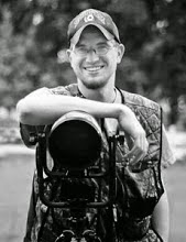
- I am 25 years old and I have been a photographer for 11 years now. I love nothing more than taking my camera out on a photo shoot with me. I mainly focus on nature photography.That is where my passion is. I love looking at all of God's wonderful creations and capturing them in the photographic medium. I have won awards and have received special recognition for my photography. It is my calling and my passion!