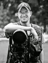
I decided to start a blog specifically for my storm chasing. I will no longer be posting the chase reports on this blog. I will however, be posting highlight photographs and a link to the storm chasing blog. Be sure to subscribe to learn about possible chases and I also have a live stream link in there as well and now you can follow along on a chase.
Thanks.
-Ben
Majestic Noise
Thursday, September 23, 2010
Thursday, September 16, 2010
Have You Picked Up Your WFLAR Today?...
Mark Moody, Elisabeth Hawley, and Richard Carter, are just a few of the several photographers showcasing their images. The WFLAR is a great non profit organization promoting literature and art in the community. I plan to submit more images for the next edition.
 |
| The new edition of the Wichita Falls Literature and Art Review. My photography is featured in this season's edition of the Wichita Falls Literature and Art Review Magazine. If you haven't heard about the WFLAR you can find out more information and where to pick one up here. |
Mark Moody, Elisabeth Hawley, and Richard Carter, are just a few of the several photographers showcasing their images. The WFLAR is a great non profit organization promoting literature and art in the community. I plan to submit more images for the next edition.
These images were featured in the WFLAR. All of them were full page (double truck) spreads. Storm on the Plains, Storms..., and Rotating Wall Cloud Hamlin, TX.
Wednesday, September 8, 2010
Cloud Formations Thanks to Hermine...
As I mentioned in my previous blog post, Tropical depression Hermine came through our forecast area. In fact the central area of circulation was over my home town, Wichita Falls, TX. Extensive cloud cover and precipitation limited instability. Therefore, the SPC was not too worried about severe weather. Low level shear profiles would support an isolated, weak tornado threat. This was enough to get me interested in a chase. I originally targeted Gainsesville, TX. I did get diverted to some developing storms near Jacksboro and Montague, TX. I should have stuck with my original target. Around 7:30pm a report came in of a brief tornado touchdown two miles north of Lindsay, TX! Oh well, that is how it goes sometimes. Though I didn't capture the tornado I still came back with some decent photos.
Hopefully we will have another chase before winter.
Thanks for viewing.
-Ben
 Outside of Henrietta, TX on US 82 I saw this scene with the desolate barn, rolled up hay bales, and feeder bands from Hermine. I had to pull over to capture this image.
 Sunlight! The sun briefly came out and thunderstorms started to form along the feeder bands.
 We had an incredible amount of moisture. Our dewpoints reached a max of 76! The result was very low bases. In this picture you can see how close the ragged base is to the Texas prairie.
Hopefully we will have another chase before winter.
Thanks for viewing.
-Ben
 Outside of Henrietta, TX on US 82 I saw this scene with the desolate barn, rolled up hay bales, and feeder bands from Hermine. I had to pull over to capture this image.
  Sunlight! The sun briefly came out and thunderstorms started to form along the feeder bands.
 We had an incredible amount of moisture. Our dewpoints reached a max of 76! The result was very low bases. In this picture you can see how close the ragged base is to the Texas prairie.
 Monday, September 6, 2010
More Storms this Week?...
Tropical storm Hermine is forecast to make its way through a portion of the southern plains from Monday-Thursday. The storm currently has a max winds at 60mph and is moving at about 15mph. While all the models show the storm breaking apart after it hits land, Hermine will still bring a substantial amount of tropical moisture. Thunderstorms are forecast from Tuesday night-Thursday morning for our area. Should be interesting to see what develops. Severe weather doesn't seem very likely right now due to the lack of CAPE on all the model runs. I should be off on Wednesday this week and I will try to do some chasing. Right now it looks like the largest threat is going to be flooding.
 NWS Graphicast depicting Hermine's path. Note how it should be right over us Wednesday afternoon.
 The SPC is not saying much for severe weather at this time. Inconsistencies in the model runs make it difficult to predict the severe potential. The have issued a Day 3 "See Text" which usually indicates a less than 5% probability of severe weather.
Saturday, September 4, 2010
09/02/10 Severe Thunderstorms in Wichita Coutny...
 Satellite image of Hurricane Earl passing to the east of North Carolina. Earl was partly responsible for our thunderstorms we had this week.
9/2/10:
A cold front was forecast to advance through our forecast area. Tropical moisture had also moved in our area thanks to Hurricane Earl. This spawned off scattered thunderstorms during the afternoon. The cold front caught up to these storms and formed into a squall line late evening. I was working at Radioshack and I remember hearing our display of weather radios all going off warning us about the severe weather on the way. There was a high wind report during this time, so I was unable to observe it, but I did watch the storm advance and got a few good gusts myself. Here is my quick report.
Thanks.
-Ben
 Radar image of the squall line. This was about 10min after the high wind report.
 Velocity scan shows a very outflow dominant storm. This is where I experienced some moderate to high winds.
 Report of a 76mph wind gust in Wichita Falls. Amazingly, there was no power loss at our location!
Subscribe to:
Comments (Atom)
About Me

- shutterbug2007
- I am 25 years old and I have been a photographer for 11 years now. I love nothing more than taking my camera out on a photo shoot with me. I mainly focus on nature photography.That is where my passion is. I love looking at all of God's wonderful creations and capturing them in the photographic medium. I have won awards and have received special recognition for my photography. It is my calling and my passion!


