
 SPC Day 1 Outlook.
 Tornado graphic. They retracted the 5%/2% area in northern OK.
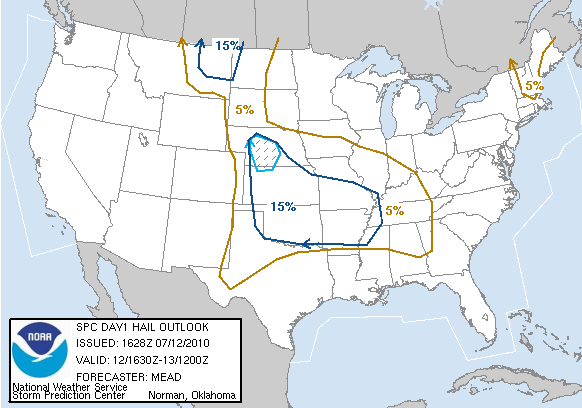 Hail graphic.
 High wind graphic.
Since I have lost my job with Metro Photo I have been feeling a little down. There is always one thing that can cheer me up--a good storm chase. The 7/12/10 chase was no exception. Ended up in north west OK and intercepted beautiful supercells. Just an incredible chase day!
Thanks for the support!
-Ben
 NWS in Norman: Graphicast for forecast area. They retract the slight risk for the lower half of OK and western north TX.
07/12/10:
Severe thunderstorms were expected to break out in northern OK. A stationary front was progged to slowly drift south from KS into northern OK. A combination of 70+ dewpoints and daytime heating yielded high instability (3500 J/kg) making the atmosphere very unstable. HRRR models were showing precipitation breaking out over Cheyenne, OK. That would be my target area. I left Wichita Falls around 2:00 and head west on 287. In Vernon I shifted to the north riding along US highway 283.

On the road for nearly 2 hours and some towers start to show up on radar. I am still 30 miles away from my target.
 On my way to Cheyenne, OK. A cu field forming and some towers starting to build.
 Storms start to break out around 4:20. I've almost reached my target, but now I need to move NE.
 SPC issues a mesocscale discussion for my target area around 4:40pm. "Severe thunderstorm watch possible".
 Cumulus towers starting to build. The storm on the right is the storm I want to chase.
 Mini LP (low precipitation) structure on this storm.
 Heading west on SR 33 I see my storm struggle to organize. I needed to pull over and capture it with the windmill.
 The storms were forming a visible mesocyclone, but the velocity scans don't show much rotation.
 My storm is look unorganized on radar, and a better cell explodes to my west.
 Here is the cell to my east and you can also see the anvil from the cell to my west.
 I am now between two supercells in Vici, OK. To my east I see a developing wall cloud. To my west a rain/hail core and developing mesocyclone.
 Storm to my east, beautiful wall cloud and tail cloud forming now.
 This wall cloud was rotating rapidly and actually produced a small (very short lived) funnel.
 The cell to my west catches up to me and I see a very convincing lowering under the wall cloud (which I am currently under in this photo).
 This storm is starting to show some rotation.
 This lowering had some insane rotation. I believe it was a developing tornado. It is about 200 yards from my location!
  This cell is catching up to me and I don't want to be in the core. I find a route that takes me south.
 The only problem is there are no routes east until I get down to SR 47.
 I pull over to shoot this structure. You can see the main updraft on the left side, the wall cloud in the center with a beaver tail inflow band, the dark core to the left, and the anvil in the upper portion.
 At this time radar showed the storm had developed an overshooting top and peaked at 62.5kft!
 Hook back up on US 183 and just wait for the storm to approach me.
 It appears the storm is trying to split.
 North of Putnam, OK. Looks like another inflow band moving into another mesocyclone.
 Radar shows four areas with mesocyclones.
 Even a few couplets show up in the velocity scans now. This storm was going nuts!
 It gets a little more organized and I watch as the storm puts on a show for me.
 Awesome structure on this storm!
 Close up of the storm's wall cloud. Some serious rising motion with rapid left-right movement.
  I was lucky to capture this brief funnel cloud a few seconds later it dissipated.
 I really need to get south before I get cored, but I just can't...
 I am just too mesmerized by this phenomenal structure! The storm has transitioned to an HP (high precipitation) supercell. Its about this time I meet up with James Langford (http://www.langfordphotography.com/) fellow photographer/storm chaser.
 Apparently we weren't the only one. There were several chasers out on this storm. Very high winds were reported about this time. With one report estimated at 80mph. You can see the downburst winds stirring up dust and precip just to the right of the mesocyclone in this picture. Judging by how quickly the dust was approaching I estimated at least 70mph.
 We heard from someone there was a radio report of a rain wrapped tornado. There were no confirmed reports on the SPC's reports page.
 The best part about this storm, was that it was movoing parallel to 183. We could get as close as we needed and move south the whole time.
 Closer up view of the mesocyclone. A small needle funnel spin up out of the cloud. Again, you can see more dust/precip getting stirred up from the downburst.
 The storm starts to split. The sun is setting and we don't really want to chase an HP supercell in the dark. This is the mesocyclone to the west.
 New mesocyclone form to our NE. We decide to call it a day and head back home.
 I head south on 183 to connect into Vernon, then from there back on 287 to Wichita Falls.
 I drove nearly 500 miles today, and my tire blows out the last 1.5 miles! LOL! Oh well, that is how it happens. Better than it blowing out while chasing those HP supercells, right?
Wow! Another memorable chase day in OK. A spectacular display of supercells on a marginal set up chase day. It doesn't get much better than that! Summer return to us this week. The NWS has already issued a Heat Advisory until thursday afternoon. For more info on heat safety visit the OUN website.


Nice to meet you out there Ben! Awesome pictures. Sorry about the tire. :( At least it was close to home!
ReplyDeleteOh. My. God. This is a great narrative of an amazing chase.
ReplyDeleteI keep watching video that James took of this storm and feel that there very well could've been a rain wrapped tornado... still hard to tell.
ReplyDeleteThat was the most awesome storm and chase to date for me and it was a pleasure getting to meet you.
~Zack